Beyond Futuristic Cameras
Beyond Futuristic Cameras
Thermal imaging converts the invisible radiation pattern of an object into a visible image. In agriculture, thermal imaging has been successfully adopted for studying plant physiology, irrigation scheduling, and yield forecasting in agricultural fields. In addition, it evaluates growth maturity, detects bruises in fruits and vegetables, and spoilage made by microbial activities.
The thermal imaging monitors the visible and near infrared radiation that plants reflect, capturing the data needed in order to take action on time. This data can identify many problems which are caused by extreme climate changes, weeds, pests and diseases, over-planting, improper irrigation, inconsistent application of fertilizers, poor drainage and more.
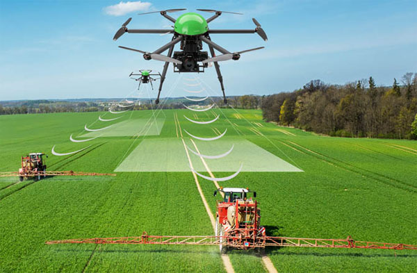
Imaging systems that are carried by drones have distinct advantages over satellite-based monitoring systems or by manned aircrafts. Their views are less likely to be hindered by clouds, they are less influenced by atmospheric perturbations, and the images are captured continuously in a timely manner under the complete control of the user. And, the operational costs are much lower.
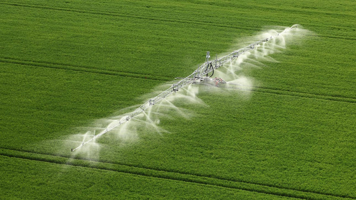
The concept of precision agriculture utilizes many tools and technologies to identify in-field variability, improve farming practices, and optimize agronomic inputs. For example, optimizing irrigation can be achieved by using thermal images to map the variability of water potential in the field. By applying water uniformly through traditional irrigation systems to a whole field, we do not take into account the variability in water uptake among plants.
Proper irrigation scheduling can reduce water stress and mitigate plant heat stress. Malfunctioning irrigation systems and non-uniform irrigation is a problem that may not be detected until viewed by aerial thermal imaging. The new technology can identify irrigation issues long before the symptoms are visually apparent or detect heat stress before the plant suffers permanent damage.
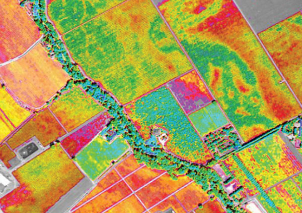
In vineyards, the lack of uniformity among vines results in variability in grape quality and in the rate of ripening, which affects wine quality. One of the basic principles of the concept of precision agriculture is to fit resources to needs, according to temporal and spatial variability in the field. Irrigating according to the principle of precision agriculture will improve water distribution in the vineyard, help reach uniform maturity, and consequently, improve wine quality. Today drones enables us to supervise and monitor large fields, detecting problems long before they endanger plants, which is crucial in agriculture.